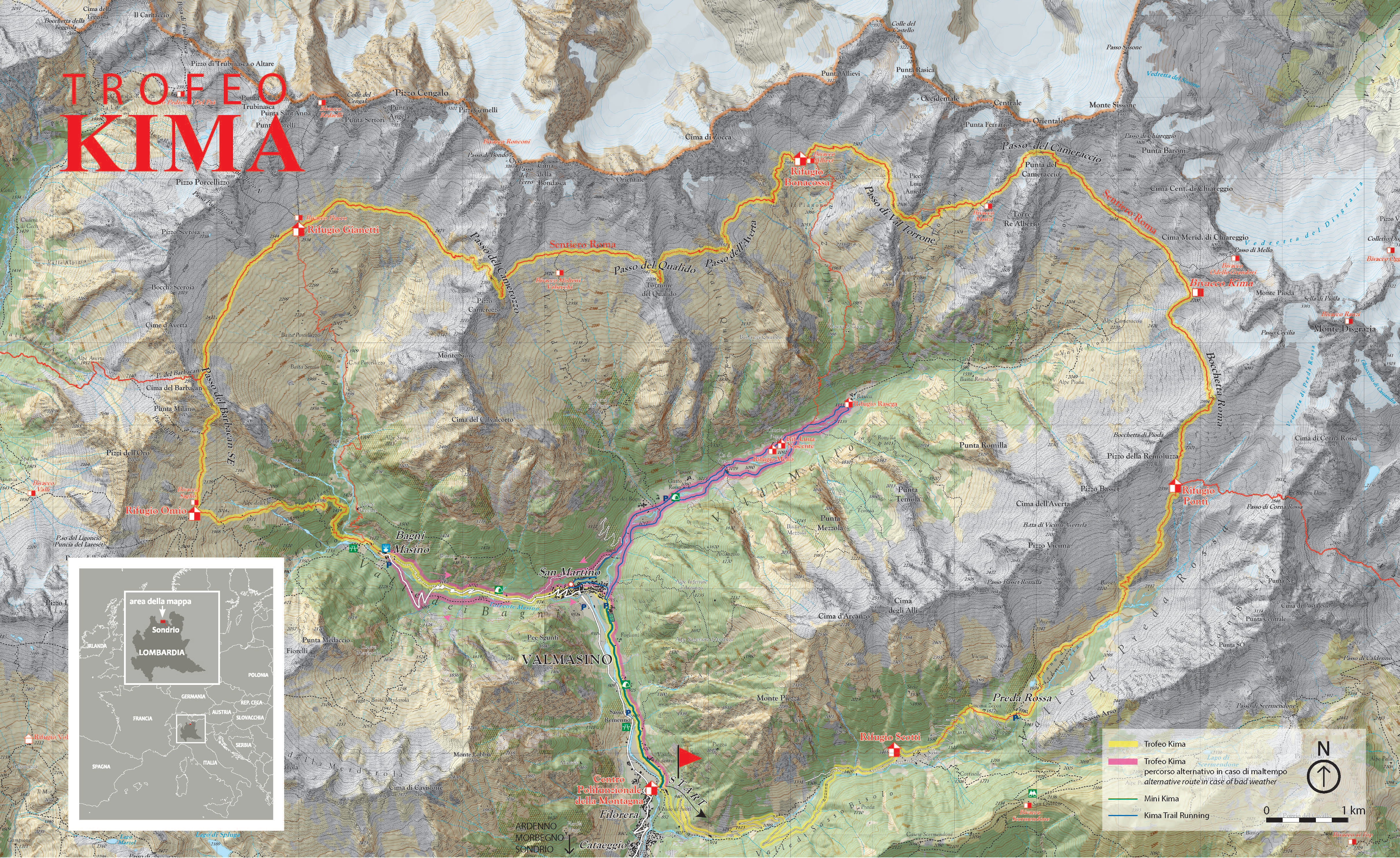
Course
Course
Start: Filorera (870m), then on to Val di Predarossa, Rifugio Ponti, Passo Cameraccio, Passo Torrone, Rifugio Allievi- Bonacossa, Passo Averta, Passo Qualido, Passo Camerozzo, Rifugio Gianetti, Passo Barbacan, Rifugio Omio, Bagni di Masino, Piana di Bregolana, San Martino and finish in Filorera (870m).

Course features
Distance: 52 km. Vertical climb: 4,200m ascent and 4,200m descent, over seven passes above 2,500m altitude. Maximum altitude: Cameraccio Pass, 2,950m (Check Point).

Aid stations
- Rifugio Scotti (water, tea)
- Preda Rossa (water, supplements)
- Rifugio Ponti (water, tea, supplements)
- Bivacco Kima, Rifugi Allievi, Giannetti, Omio, Bagni di Masino (water, tea, supplements, food)
- Passo Cameraccio (water, supplements)
- Passo Qualido, Ferro, Barbacan, San Martino (water, supplements)
- Arrivo (water, tea, supplements, food)
Technical features
The race takes place on mountain paths but with demanding stretches both uphill and downhill and, in certain parts, fixed ropes, snow, exposed ledges, steep slopes and stony terrain – in other words, requiring good physical preparation and extreme caution.
The entire course is marked with the Sentiero Roma white-red-white signage; with orange fluorescent flags; and, in the lower stretches and at road crossings, with red and white tape and yellow arrows. Every pass has an information board showing the number of kilometers into the race and the number left to run.
It’s compulsory to follow the marked course – or risk disqualification. Along the course there will be fixed check points and time limits. At every refuge, and at certain points along the course, medical assistance will be available. The medical team has the faculty of deciding if an athlete should retire and consign their bib.
